Sovereign data
We rely on domestic imaging sources: that's resilience and an evidence base for public-sector and financial tasks.
About
AstraField is a hyperspectral action system for commercial farms in southern Russia. We read the field's signals from space, resolve them into a cause (nitrogen, moisture, biomass, gaps or stress), confirm them on the ground and by drone, and launch the action that saves expensive inputs and cuts the losses from wrong moves.
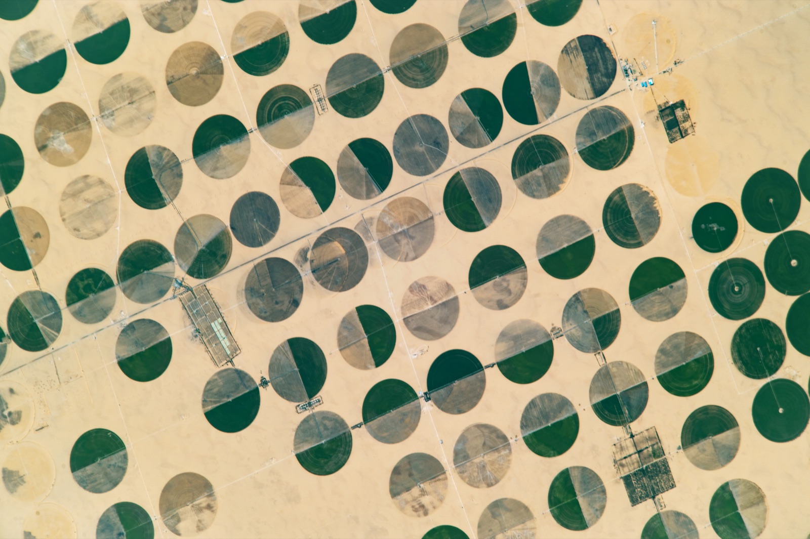
Stress, nitrogen deficit, lack of moisture, gaps in the stand, all of it shows up in the spectrum before it's visible to the eye. Between the “process” and the “result” there is a window in which intervention still changes the yield. Our job is to hand that window to the agronomist.
We work in the south, where farming is risky: moisture is uneven, cloud cover hides the field at the wrong moment, and inputs are expensive. So we combine several imaging types (all-weather radar, multispectral and hyperspectral) and top them up with sovereign high-resolution imagery where verification is needed.
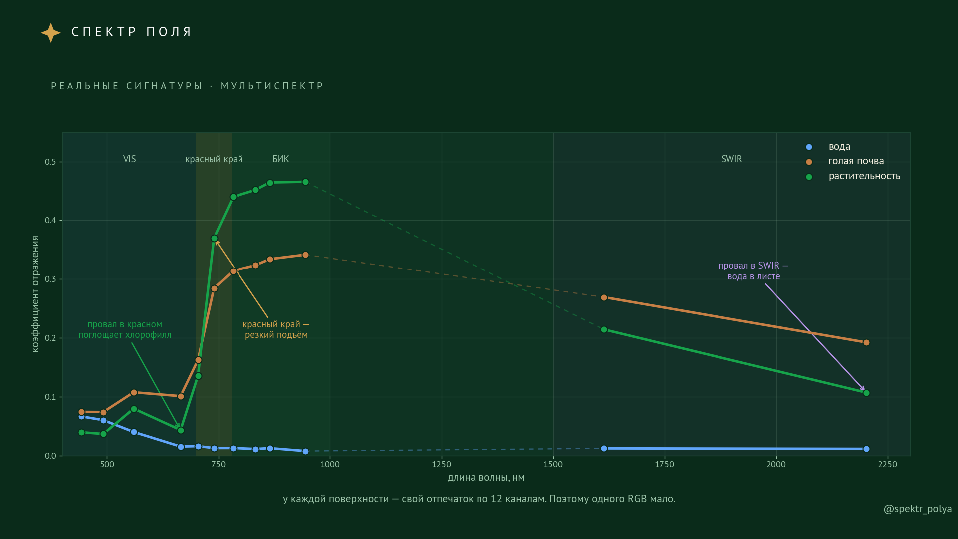
Where multispectral sees a few broad channels, hyperspectral reads hundreds of narrow bands. That is the step from a general assessment of condition to leaf biochemistry.
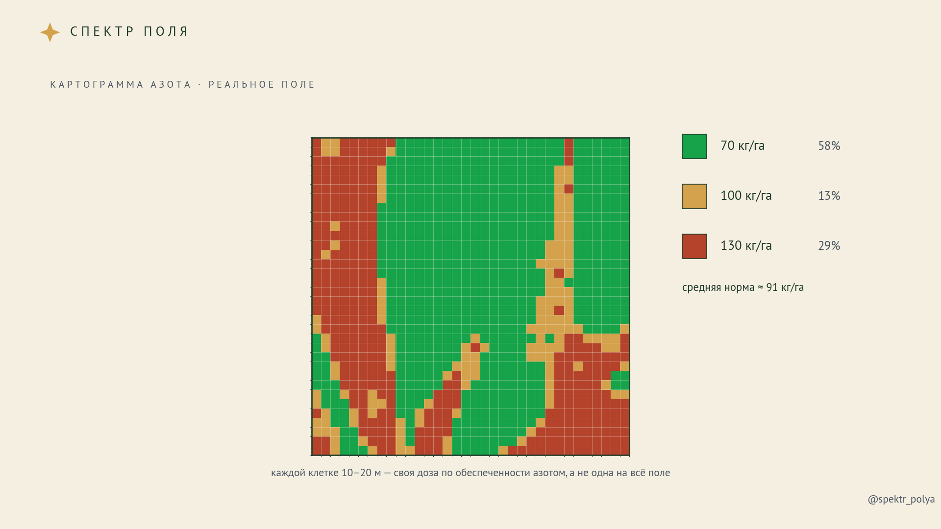
The product is being proven on real fields in the region. We deliberately make no loud promises and name no one else. We show what is visible from space and honestly mark where the method's limits lie.
We rely on domestic imaging sources: that's resilience and an evidence base for public-sector and financial tasks.
A pretty index isn't a result. The result is measured by the agronomist's action and the money saved: where inputs went, where the sprayer stayed home, what wasn't lost.
We say plainly what the method can't do. Satellites remove blind spots but don't replace soil analysis and a person on the ground.
The model is refined on a specific farm's ground data, it doesn't pass off someone else's percentages as yours.
Cause. Confirmation. Action.
One product turns a field's spectrum into a concrete step. Start with a free pilot on your own fields.